Body
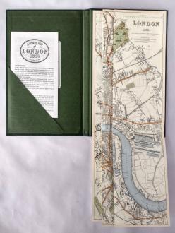
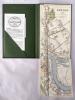
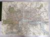
A Street Map of London 1843. This is a modern reprint of the 1843 map published by The Society For The Diffusion Of Useful Knowledge.
Bound in a green rexine folder the map is 38.2cm x 65.5cm. A very detailed view of London in 1843 showing major buildings, parks, roads, railroads, docks, and the River Thames.
Edition
Reprint, 1992
Book Publisher
Old House Books
Book ISBN
none listed
Book Dimensions
24 × 17 × 1.5 cm
Condition
Very good. Previous owners bookplate pasted inside front board
Stock Level
1
Price
£8.00
Variations
Images